

| A new Public Park in the Kirkstall Valley | |
|---|
This multimedia website describes proposals to establish a new public park in the Kirkstall Valley in central Leeds. It would be the largest public recreational project in Leeds for over seventy years, comparable in size with Roundhay Park, Middleton Park or Hyde Park in central London. This website includes a short history of the area and numerous maps and photographs of the locality. Each picture is initially represented by a small, low resolution image so that the pages will load quickly. If you have a modern browser, a fast internet connection and a high resolution monitor you can replace these low resolution images with much larger and more detailed versions. Click the image titles to enlarge the pictures, or tab through the titles then press any key to load the larger versions. A Table of Contents with access keys, and an alternative text-only website are available.
The Kirkstall Valley is one of Leeds’ best kept secrets. Very few people are aware of this substantial area of open space immediately adjacent to the city centre. The valley is sandwiched between Armley, Burley and Kirkstall, but physical barriers created by the Leeds - Skipton railway, the River Aire and the Leeds – Liverpool canal make it difficult to explore this part of our city. People either imagine that there is nothing there, or assume that the land was irretrievably damaged by its previous industrial heritage. Nothing could be further from the truth.
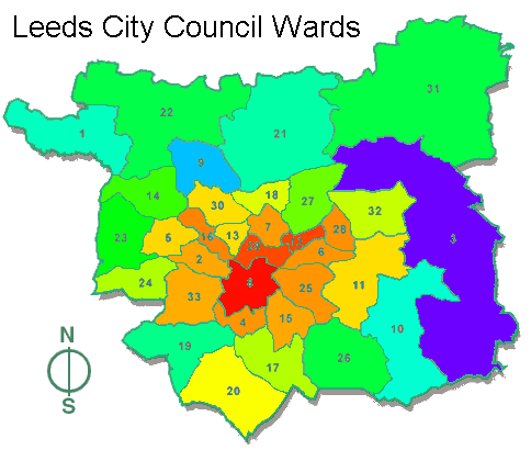
The Kirkstall Valley is very close to Leeds city centre. Some neighbouring areas suffer from significant traffic problems, economic disadvantage and a serious shortage of recreational open space. These handicaps are reflected by a wide range of socio-economic indicators. For example, the image below shows the frequency of child road accidents in Leeds City Council wards on a spectral scale, where red represents the highest accident frequencies per head of population and blue the lowest. School children in central Leeds face ten times the risk of a serious road accident when compared with their counterparts in the outer suburbs. Inner city children need safer places to play.
Prior to the industrial revolution the River Aire was a famous salmon fishery, but industrial pollution from Bradford Beck, and inadequately treated effluent from Esholt sewage works eliminated much of the aquatic wildlife. Water quality is now substantially improved with the decline of the textile industry, control of moth-proofing residues and the introduction of tertiary treatment at the Esholt plant. Salmonid fish and otters have re-colonised the river, although a full salmon migration is impeded by the remaining weirs. The valley is a favourite spot for bird watching. It is a few degrees warmer than the surrounding open countryside, and it forms a natural migration route for birds, so it attracts a wide variety of avian species.
Katy Hockridge and Val Crompton write:
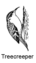
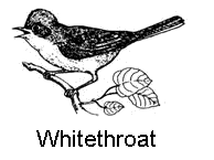 Birds to watch out for arriving on migration from the South in March, April and May are Sedge warblers, Willow warblers, Chiffchaffs and Whitethroats. All year round near the big pond look out for reed buntings. In the Autumn listen out for the 'chuckling' of the Fieldfares and the high pitched calls of the Redwings at they migrate in from the East. Often at night you can hear these high pitched calls as Redwings migrate over Leeds. Look out for blackbirds taking berries off the Hawthorns. Other common birds resident all they year round are Kingfishers, Treecreepers, Sparrows, Greenfinches, Goldfinches, Wrens, Robins and Dunnocks. Sparrowhawks, Kestrels and Herons are seen regularly flying above the reserve. 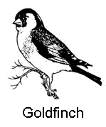
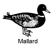
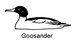
Very occasionally Curlews fly over and, rarely, Woodcocks. On the river look out for Mallards and Tufted ducks. Also Goosanders are regular in the winter. A Waterail has been recorded from the bridge over Redcote Lane. The lake on the island attracts Moorhens. 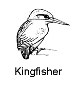
Happy birding! Records of additional sightings will be gratefully received. See the contacts pages for more information. |
Local history can be traced from the foundation of Kirkstall Abbey in 1152. The abbey prospered and the monks developed agriculture, leather working and a bloom-smithy ironworks at Weetwood. There is little evidence to support the local belief that the monks worked iron at Kirkstall Forge, which remained a fulling mill until the 17th century. Water power has long been used for a variety of industrial purposes including fulling, scribbling, oil and corn mills. The weirs at Armley Mills and Kirkstall Abbey date from medieval times, but during the 18th and 19th centuries the valley became a major centre for the woollen industry, and a complex network of weirs and goits was constructed to supply additional energy. Many of these works survive to the present day.
Abbey Mills is clearly marked on a 1711 map of the Earl of Cardigan's estate. Savins Mills and St Ann's mills were constructed later on the same stream, and both are shown on Jeffery's map surveyed in 1771.
James Graham was a wealthy lawyer who married Ann Moore in 1781, and thereby acquired a 500 year lease on parts of the Earl of Cardigan's estate in the Kirkstall Valley. Graham either built or re-built several mills along the network of weirs and goits in the Kirkstall valley.
Benjamin Gott was a major Leeds industrialist who re-built Armley Mills in 1806 after a fire. He also occupied Burley Mills (1798) and St Ann's Mills (ca. 1824) in the valley floor. Gott became Mayor of Leeds in 1799 and was a millionaire by the time he died. His house (1820) and grounds (designed by Humphrey Repton) overlooked the valley from the Armley side. In 1928 both properties were leased by Leeds City Council to create a municipal golf course and public park.
Water power was superseded by steam around 1820 and the water mill that was planned to match the big weir was never built. Woollen manufacture remained profitable for much of the 19th century, and most of the mills in the Kirkstall valley were considerably enlarged by the addition of single storey weaving sheds. Hardly any of these buildings survive to the present day, and the Leeds City Council Industry and Estates department has been responsible for much of this needless destruction.
After 1931 the area was dominated by the Kirkstall power station, an early municipal enterprise that was nationalised after 1945. This extremely dirty coal-fired unit covered the surrounding streets in fly ash. The station was converted to burn oil just in time for the Middle East war, and the resulting price rise resulted in its closure in 1976. The former fly ash lagoons were filled with rubble, mostly from the Leeds inner ring road, but the valley remains a major switching centre for the National Grid. The restricted access, in combination with overhead and underground high-voltage cables, subterranean voids and contaminated, unstable land make the power station site unsuitable for residential development.
The River Aire floods at irregular intervals, and as a result the valley floor has remained largely free from built development. The same flooding has left rich deposits of alluvial soil, and the Burley Mills allotments are mostly classified as Grade One agricultural land after a survey by the Ministry of Agriculture Fisheries & Food (MAFF) in 1989. They are the best farmland in the Leeds Metropolitan District. Significant built development is precluded by the flood plain and agricultural land designations.
Flooding became a major issue during the summer of 2008, because the council started trying to market St Ann's Mills for intensive office or residential development, even though it is in the high risk flood plain. This is directly contrary to national government guidance and adopted council policies. There is a flooding section to this website devoted to these issues.
The canal was completed in 1816. In contrast to the River Aire, it has largely unpolluted water drawn from various Pennine catchments. This large body of clean, slow moving water is the home to various rare species of freshwater mollusc that resulted in its designation as a Site of Special Scientific Interest in 1984. The canal was once used to supply the power station with coal, and the former coal basin and loading bay have been converted into a narrow boat marina.
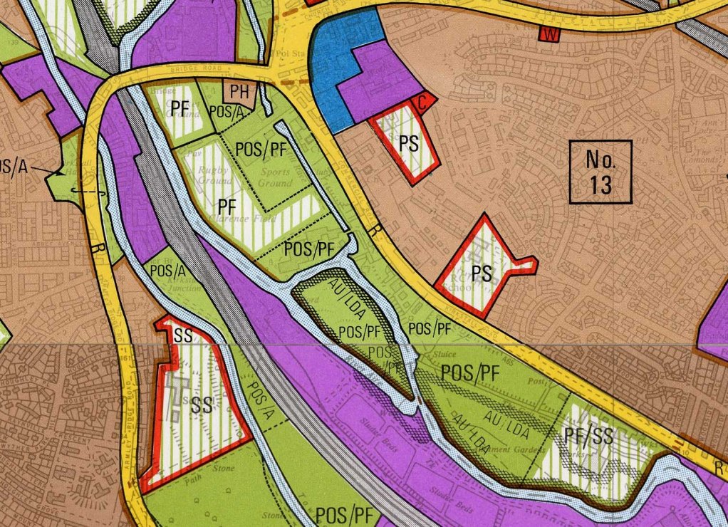
Leeds City Council recognised the potential of the Kirkstall riverside during the 1950s, and embarked on a systematic program of land acquisitions that included Stansfield Row (1959), 649 Kirkstall Road (1963), St Ann's Mills (1970) and Burley Mills and Burley Mills Allotments (1975). This last site had been leased by the Council since 1954. Although Kirkstall power station was still zoned as industrial land, the entire area between the River Aire and Kirkstall Road was allocated as playing fields and public open space in the 1972 Development Plan Review. Proposals for a Kirkstall Valley Park were included in the 1980 Local Plan, and in 1983 the Museums section of the LCC Leisure Services Department published "The Kirkstall Valley Guide". This envisaged a park extending all the way from the city centre out to Rodley and Horsforth, that also included Bramley Fall and Beckett Park.
Work started on a variety of low-cost projects, many of them under community control. The Kirkstall Village Community Association managed a Community Programme scheme which constructed a "Goitside Walk" along Abbey Mill Goit below Bridge Road, and subsequently a Goitside Walk Extension towards Burley Mills. Planning approval 87/26/401 was obtained for a Nature Garden alongside Kirkstall Road and footpaths were constructed on the site. The intention was to join all these paths together to form a continuous waterside route, but this work was not completed for the reasons explained below. Another imaginative scheme for a Kirkstall Nature Reserve won first prize during the European Year of the Environment in 1987 - 88. This resulted in the foundation of EYE on the Aire, an organisation which until recently campaigned on water quality and wildlife issues, achieving some major improvements to the river.
Unfortunately, while all this work was in progress, officers within the Council's Industry and Estates Department decided that they had a better idea. Working almost entirely in secret, and without the knowledge or approval of most elected members (or the public) they devised an enormous commercial development scheme and shortlisted six companies to tender for the development rights. The park proposals fell victim to these political manoeuvrings and in 1988 the valley came under the control of the Leeds Development Corporation (LDC), a non-elected "quango" created by Mrs Thatcher’s government. After a failed attempt to create a major retail and office development, LDC bowed to popular pressure and partially implemented the proposed Kirkstall Valley Nature Reserve in 1992. Other LDC planning decisions were less benign and caused enduring damage to the surrounding area.
Although LDC made it more difficult to implement the original 1980 vision for a Kirkstall Valley Park, much of value still remains. The area is permanently in danger from incremental, piecemeal development. The present proposals are an attempt to stabilise the situation, and to dedicate the remaining land as public open space, to serve the surrounding, densely populated areas.
About half of the additional land is already in Council ownership while the remainder is in a variety private hands. Some has already been developed, and some is still required as operational land by the railways and the electricity distribution companies. For the excellent reasons explained above very little of the remaining land is likely to be a candidate for major built development in the foreseeable future. The present scheme would formalise that position, and effectively dedicate all of the remaining vacant land as recreational open space.
Although the new park would become a recreational area, significant surveying, design and construction work are needed to improve public access and bring it into beneficial use. This would include footpaths, cycleways, bridges, administrative offices, toilets and educational facilities. It might eventually include some fairly ambitious civil engineering and rebuilding works, as explained in the projects section of this website. At present the railway, river and canal divide the land into parallel strips and make it quite difficult to get from one part to the other. Many of these development operations have enormous potential as educational and training exercises, and would be free from the strict time constraints that often make it difficult for trainees to work on fully commercial schemes.
The essence of these proposals is to bring together a large pool of "free" labour and underused land with money from the charitable sector and from central government grants. The scheme requires a partnership between Leeds City Council, the Probation Service, educational institutions, private companies, voluntary organisations and local community groups. The democratic input from the general public will be achieved indirectly via Leeds City Council and the participating voluntary organisations. We do not consider that it is practicable to organise direct elections to the management committee.
We have established a not-for-profit company called Kirkstall Valley Park (KVP) which is limited by guarantee, to promote and eventually manage the Kirkstall Valley Park. This type of limited company can provide a broadly-based governing body, seek charitable status, form partnerships and attract external funding. It is a stable, formal structure that can sign contracts and handle substantial amounts of money. In the unlikely event of winding-up the assets would either revert to Leeds City Council and the other participating landowners, or be distributed to other charities with similar objectives. This scheme closely accords with current government policies, and therefore stands an excellent chance of obtaining political and financial support.
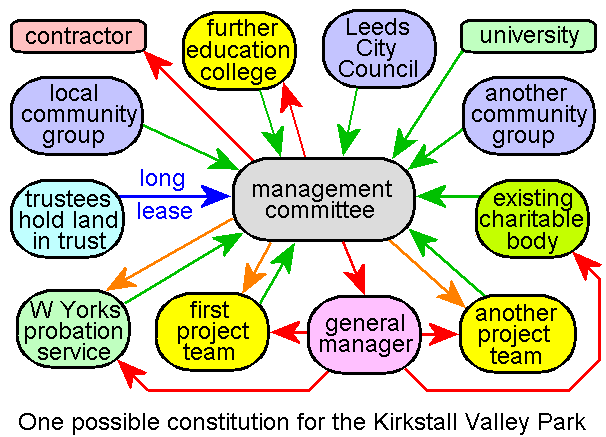
It is not easy to draft an efficient constitution that will simultaneously serve the needs of the general public, government departments, an elected local authority, two universities, six further education colleges and a plethora of voluntary organisations and community groups. At present the participating organisations (rather than individuals) elect the KVP Directors who are the management committee. A separate organisation (such as Wades Charity) might ultimately hold land and other resources on trust, on behalf of the park, and lease them to the management committee. [This ingenious legal device is currently used in several Leeds parks to frustrate asset-stripping by cash-strapped politicians!] The KVP Directors meet about 8 times each year to set strategic objectives, but most of the detailed work will be done by specialist sub-groups, or by contractors, who are focused on a particular task.
Download the Memorandum and Articles of Association for Kirkstall Valley Park.
 |
 |
 |
 |
 |